Along the Bucktail Highway
Nonfiction, Art & Architecture, Photography, Pictorials, Travel, Lodging & Restaurant Guides| Author: | Charles E. Williams | ISBN: | 9781439619995 |
| Publisher: | Arcadia Publishing Inc. | Publication: | January 9, 2008 |
| Imprint: | Arcadia Publishing | Language: | English |
| Author: | Charles E. Williams |
| ISBN: | 9781439619995 |
| Publisher: | Arcadia Publishing Inc. |
| Publication: | January 9, 2008 |
| Imprint: | Arcadia Publishing |
| Language: | English |
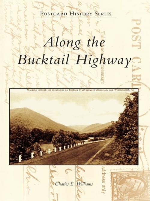
The Bucktail Highway, Pennsylvania Route 120, traverses over 100 miles of the commonwealth�s historic northern tier, linking Ridgway in the west with Lock Haven in the east. The Bucktail Highway crosses the eastern continental divide east of St. Marys and closely follows the picturesque, deep valleys carved by Sinnemahoning Creek and the West Branch of the Susquehanna River. Originally a Native American path and later a road that carried settlers west beyond the Allegheny Front, today�s Bucktail Highway is a centerpiece of the Pennsylvania Wilds, a public-private initiative to promote and conserve the unique natural and historic resources of the region. Along the Bucktail Highway showcases over 200 vintage postcards profiling the cultural and natural history of the towns, forests, and waters linked by this scenic route from its beginnings as a westward trail, its growth as a commercial and industrial corridor in the late 1800s and early 1900s, and its recent emergence as a premier Pennsylvania scenic byway.
The Bucktail Highway, Pennsylvania Route 120, traverses over 100 miles of the commonwealth�s historic northern tier, linking Ridgway in the west with Lock Haven in the east. The Bucktail Highway crosses the eastern continental divide east of St. Marys and closely follows the picturesque, deep valleys carved by Sinnemahoning Creek and the West Branch of the Susquehanna River. Originally a Native American path and later a road that carried settlers west beyond the Allegheny Front, today�s Bucktail Highway is a centerpiece of the Pennsylvania Wilds, a public-private initiative to promote and conserve the unique natural and historic resources of the region. Along the Bucktail Highway showcases over 200 vintage postcards profiling the cultural and natural history of the towns, forests, and waters linked by this scenic route from its beginnings as a westward trail, its growth as a commercial and industrial corridor in the late 1800s and early 1900s, and its recent emergence as a premier Pennsylvania scenic byway.
